Bryce Canyon
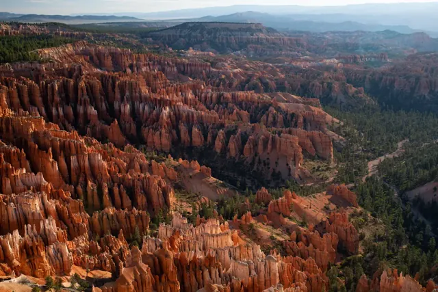
Hoodoos (irregular columns of rock) exist on every continent, but here is the largest concentration found anywhere on Earth. Situated along a high plateau at the top of the Grand Staircase, the park's high elevations include numerous life communities, fantastic dark skies, and geological wonders that defy description.
Official-source overview · detailed planning coverage is still being reviewed
At a glance
- State / territory
- Utah
- Region
- Southwest
The official overview below is available now. Park-specific fees, distances, climate tables, and reviewed day plans are shown only when their supporting records have been reviewed. Check current access and arrangements with the park before travel.
Plan this visit
Build your park visit
Use this interactive tool with JavaScript enabled. Park guides and official information remain available below.
When to go
Due of its high elevation climate, weather at Bryce Canyon through autumn, winter, and spring can be highly variable. From October to May temperatures fall below freezing nearly every night. The park typically experiences its coldest and snowiest periods from December through February. Spring storms in March and April can still produce heavy snowfall that may impact travel in the region. Summer highs are typically in the 70s-80s F and afternoon thunderstorms are common in July and August.
General official weather guidance; historical context, not a forecast.
Arrive and stay
From the North:
Take I-15 south to UT-20 (exit 95). Travel east on UT-20 to US-89. Follow US-89 south to UT-12. Travel east on UT-12 to UT-63. Take UT-63 south to Bryce Canyon NP.
From the South through Zion National Park:
Take I-15 north to UT-9 (exit 16). Follow UT-9 east through Zion National Park to US-89. Travel north on US-89 to UT-12. Go east on UT-12 to UT-63. Take UT-63 south to Bryce Canyon NP.
From the East
Travel west on UT-12 to UT-63. Take UT-63 south to Bryce Canyon NP.
Risks and official checks
Conditions, access, reservations, and operating hours can change. This website is a planning resource and does not provide live conditions.
Official park informationSources and your trip kit
Where this information comes from
Park overview information is drawn from identified official sources. Published guide facts, assumptions, and editorial decisions retain their own review records.
Source retrieved: 2026-10-01. This is not a live-conditions check.
National Park Service: Bryce Canyon
Image credit: NPS Photo / Peter Densmore. See the image credits.
Data release 0 · Independent planning resource. Not affiliated with the National Park Service.