Canyonlands
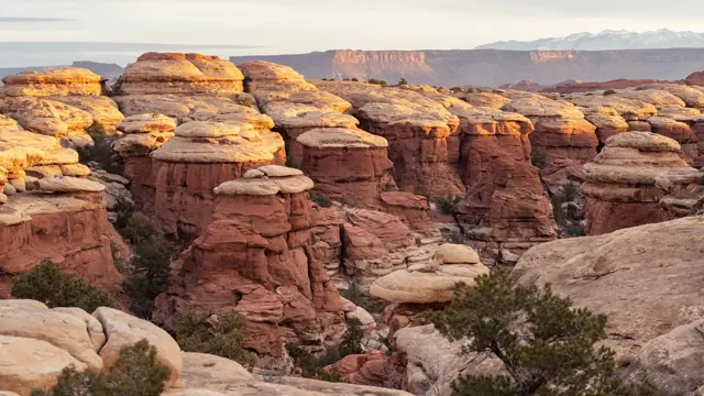
Canyonlands is a wilderness of canyons, buttes, and spires carved by the Colorado River and Green River. The park is divided into four distinct districts; no roads join them together. The districts share similar desert ecosystems, but each one provides unique opportunities for adventure and discovery.
Official-source overview · detailed planning coverage is still being reviewed
At a glance
- State / territory
- Utah
- Region
- Southwest
The official overview below is available now. Park-specific fees, distances, climate tables, and reviewed day plans are shown only when their supporting records have been reviewed. Check current access and arrangements with the park before travel.
Plan this visit
Build your park visit
Use this interactive tool with JavaScript enabled. Park guides and official information remain available below.
When to go
Canyonlands is part of the Colorado Plateau, a "high desert" region that experiences wide temperature fluctuations, sometimes over 40 degrees in a single day. The temperate (and most popular) seasons are spring (April-May) and fall (mid-September-October), when daytime highs average 60 to 80 F and lows average 30 to 50 F. Summer temperatures often exceed 100 F, making strenuous exercise difficult. Winters are cold, with highs averaging 30 to 50 F, and lows averaging 0 to 20 F.
General official weather guidance; historical context, not a forecast.
Arrive and stay
Canyonlands National Park is cut into three land districts by the Green and Colorado rivers. Island in the Sky, in the north of the park, is about 40 minutes from Moab, UT via UT 313. The Needles district is in the southeast corner of Canyonlands, about 90 minutes from Moab or an hour from Monticello, UT via UT 211. The Maze district, in the west of the park, is the most remote and challenging; its ranger station is down 46 miles of dirt road from UT 24. All roads in The Maze require high-clearance 4WD.
Official directionsRisks and official checks
Conditions, access, reservations, and operating hours can change. This website is a planning resource and does not provide live conditions.
Official park informationSources and your trip kit
Where this information comes from
Park overview information is drawn from identified official sources. Published guide facts, assumptions, and editorial decisions retain their own review records.
Source retrieved: 2026-10-01. This is not a live-conditions check.
National Park Service: Canyonlands
Image credit: NPS/Rhodes Smartt. See the image credits.
Data release 0 · Independent planning resource. Not affiliated with the National Park Service.