Guadalupe Mountains
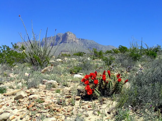
Come experience mountains and canyons, desert and dunes, night skies and spectacular vistas within a place unlike any other. Guadalupe Mountains National Park protects the world's most extensive Permian fossil reef, the four highest peaks in Texas, an environmentally diverse collection of flora and fauna, and the stories of lives shaped through conflict, cooperation and survival.
Official-source overview · detailed planning coverage is still being reviewed
At a glance
- State / territory
- Texas
- Region
- Southwest
The official overview below is available now. Park-specific fees, distances, climate tables, and reviewed day plans are shown only when their supporting records have been reviewed. Check current access and arrangements with the park before travel.
Plan this visit
Build your park visit
Use this interactive tool with JavaScript enabled. Park guides and official information remain available below.
When to go
The Guadalupe Mountains are known for high winds year-round; gusts can reach 60MPH or higher. In winter the mountains experiences occasional, light snowfalls which seldom last more than a day. From May through October, temperatures vary with highs between 80F-100F+ with lows in the 40F-60F range. November to April is generally milder with highs in between 50F-70F with lows in the 30F-50F range. Elevations above 8,000’ will be about 10F cooler than headquarters, with corresponding wind-chill.
General official weather guidance; historical context, not a forecast.
Arrive and stay
Guadalupe Mountains National Park is located on the north side of US Hwy 62/180.
If you are traveling east from El Paso, TX, we are 110 miles East of the city. Follow US Hwy 62/180 North to the Pine Springs Visitor Center.
If you are traveling from Van Horn, TX, you will travel north on US 54 and make a right-hand turn at the junction of US 62/180 to arrive at the park.
If you are traveling west from Carlsbad, NM, you will travel on US Hwy 62/180 South and cross into Texas. Follow signs to the park.
Risks and official checks
Conditions, access, reservations, and operating hours can change. This website is a planning resource and does not provide live conditions.
Official park informationSources and your trip kit
Where this information comes from
Park overview information is drawn from identified official sources. Published guide facts, assumptions, and editorial decisions retain their own review records.
Source retrieved: 2026-10-01. This is not a live-conditions check.
National Park Service: Guadalupe Mountains
Image credit: NPS/Bieri. See the image credits.
Data release 0 · Independent planning resource. Not affiliated with the National Park Service.